
Search a Pembroke Pines Street
Begin with one complete street address. Broward County, not Pembroke Pines City Hall, keeps the property ownership roll and recorded land instruments. The city keeps permits and code records. That split matters because a city address search cannot replace a county parcel search. The most reliable Pembroke Pines street directory workflow moves from the address to its folio, then uses that stable parcel number to connect records that spell or format the street in different ways.
Work outward only after the first parcel is confirmed. A street number, owner name, legal description, and map position should agree. Then compare the lots next door in the official map. This keeps a similarly named road, a unit number, or a postal-city mismatch from pulling an unrelated parcel into the street search.
- Enter the full address in the Broward County Property Appraiser record search. Save the folio, situs address, legal description, and current owner field.
- Open that folio in the county parcel map. Check the parcel shape and click adjacent lots before collecting a larger group.
- Use the folio in Pembroke Pines permit records. Compare the address, permit dates, work type, and public attachments.
- Search the named owner in Broward Official Records. Match the folio or full legal description before accepting a deed.
- For older household clues, check an address section or criss-cross directory at Broward County Library, then compare nearby editions.
Pembroke Pines Address Search Fields
The BCPA search accepts several paths into the same roll. Address search is best for one known property. Subdivision search helps when street spelling or postal wording fails. Owner search can confirm other parcels held under the same recorded name, but a common name needs added checks. Folio search is the cleanest bridge because the folio identifies the parcel rather than a person.
| Search choice | Entry | Best use | Check in result |
|---|---|---|---|
| Address | Street number and name | One known Pembroke Pines lot | Situs, owner, folio |
| Owner | Recorded owner name | Confirm a name after address search | Mailing address and name form |
| Subdivision | Plat or subdivision name | Group lots when street wording fails | Legal description |
| Folio | Parcel identification number | Link map, permits, and deeds | Exact parcel match |
A result mixes facts from different dates. The owner field reflects the current assessment system, the sales table reflects recorded transfers, and exemption values belong to a tax year. Do not treat all fields as proof of one current household.
Pembroke Pines Situs and Mail
The situs address is the physical location of the parcel. The mailing address is where the property office sends owner correspondence. They can match, but they need not. A different mailing address may belong to an absentee owner, a trust, an estate representative, or a care-of recipient. It does not prove that the person named there lives on the Pembroke Pines street being researched.
Homestead notation plus matching mailing and situs addresses can support the limited conclusion that at least one owner claimed a homestead benefit. It still does not identify every occupant. BCPA may use a percent sign as a care-of marker and “ETAL” to mean additional named parties. Read the full record before treating a clipped owner line as complete.
- Parcel
- A legally defined piece of land tracked by a folio.
- Situs address
- The physical address assigned to the parcel.
- Plat
- A recorded map that divides land into lots, blocks, roads, and easements.
- Criss-cross directory
- A directory arranged by street and number rather than only by surname.
Note: Owner, mail recipient, and occupant are separate roles, even when the same name or address appears in several fields.
Map Pembroke Pines Street Parcels
The BCPA parcel map is the strongest tool for walking a block in order. Search by address, owner, or folio, then identify the highlighted parcel. Standard navigation includes zoom and pan. Identify Parcels opens details for a clicked lot, while Collect Parcels assembles a selected set. The result can show folio, owner, situs, mailing address, legal description, property use, values, exemptions, building details, and sales references.
View the Broward parcel map interface before expanding the street-by-street search.

The map image shows why parcel edges matter. A mailing label, ZIP code, or street line may suggest a place, but the mapped polygon and folio tie the result to the actual lot.
Pembroke Pines Street Record Sources
No public source is a complete list of residents. A sound street directory treats each record as one layer. Property and deed sources center on ownership. Permit files describe work at a site. Voter material has a different legal purpose and is incomplete by design. Older directories capture only the people the publisher listed.
| Address record | Custodian | What it can show | Access route |
|---|---|---|---|
| Property roll | Broward Property Appraiser | Owner, situs, mailing address, folio, sales references | Free record search or map |
| Official records | Broward Recording Section | Deeds, mortgages, liens, plats, and legal descriptions | Online index; older media at Search and Copy Services |
| Permit history | Pembroke Pines | Permit type, work, status, inspection history, public attachments | Development HUB or focused records request |
| Voter extract | Broward Supervisor of Elections | Lawfully releasable registration fields by geography | Focused request for an existing electronic extract |
| Address directories | Broward County Library | Published subscribers or household heads in a given edition | Library databases, microfiche, and staff request |
The folio is the useful connector. Broward Official Records is not indexed by street address, so carry the current owner's name and parcel legal description into the grantor-grantee search. For a deep backward chain, continue on the Pembroke Pines previous residents search.
Pembroke Pines Deeds by Street
BCPA sale references can point toward a recorded instrument, but the deed image must still match the parcel. Search Broward Official Records by the owner name and likely transfer period. Then confirm the same folio or full legal description. Party continuity alone is weak when names are common, changed, abbreviated, or held by trusts.
The recorder divides access into clear eras. Fully searchable official records begin July 7, 1977 at 1:47 p.m. A limited instrument, book/page, and date bridge reaches March 9, 1972. Earlier media, including land records that reach 1871, require Search and Copy Services in Fort Lauderdale. Online images can be viewed and copied free; the counter handles older media and certified copies.
Open Broward County's records overview for the online and counter routes.
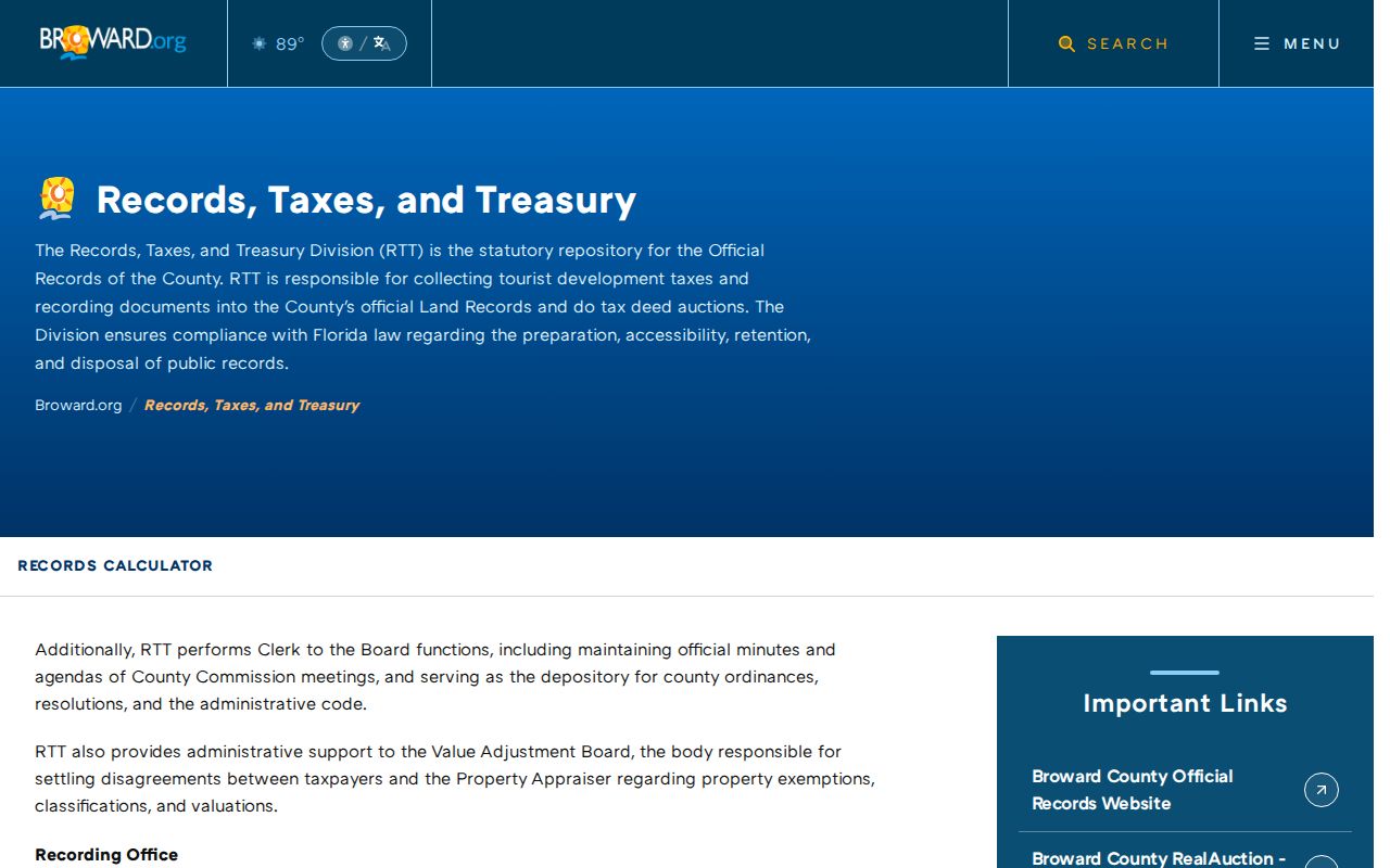
The overview reinforces an important limit: a street address opens the parcel search, while a name, instrument number, book/page citation, date, or legal description carries the work into recorded documents.
Pembroke Pines Permits by Address
Pembroke Pines permit history adds the physical story of a site. The official CSS instructions direct a user to Search Public Records, choose Permit, and enter parcel information. The city recommends the BCPA folio or property ID. Results may export permit history to a spreadsheet. An opened permit can show its type, work description, status, inspections, public approved attachments, and fee history.
Online eras are split. Historic Anzio data covers 1992 through August 2, 2009. The later system covers August 3, 2009 forward, and EnerGov launched in 2022. When the portal does not return a needed file, use the Pembroke Pines public-record request channels. The city accepts GovQA, anonymous requests, mail, fax, email, telephone, and in-person requests. A narrow request should include both address and folio.
Permit records can date construction or alterations. They do not prove who slept at the address when the work occurred.
Pembroke Pines Street Name Change
One local name change can break an otherwise careful search. Hollywood Boulevard became Pines Boulevard within the city on January 1, 1974, under Resolution 656. Search both names when following an address across that date. Before 1960, also try West Hollywood as the locality because Pembroke Pines passed through village, abolition, restoration, and later city status.
An address can change its indexing vocabulary without moving. A regional phone directory may use a postal community, the recorder may rely on a subdivision and legal description, and the city may file by municipal jurisdiction. The reliable bridge is old street name plus new street name, matched to a folio, legal description, map, and date.
Note: Far-west annexation by 1981 creates another era check when a modern Pembroke Pines address is absent from older city files.
Pembroke Pines Voter Street Limits
The Broward voter lookup is an identity-gated self-service status check, not a public reverse street directory. A separate public extract may support lawful geographic analysis, subject to protected flags and confidential fields. The current county order form and fee were not verified, so request an existing electronic extract by fields, geography, and snapshot date rather than expecting a downloadable street search.
Florida law keeps Social Security numbers, driver-license or state-ID numbers, signatures, and registration sources confidential. Protected addresses are suppressed. Voting history records participation, not ballot choices. Inactive status alone does not prove a move because list maintenance has its own timing and process.
Pembroke Pines Criss-Cross Clues
An older criss-cross directory can add a published name to an address, including some occupants who never owned the parcel. Broward Main Library is the strongest local fallback. Its fifth-floor Periodicals unit holds older telephone directories on microfiche and South Florida newspaper runs. The sixth-floor Broward Historical Archives holds local records and finding aids. Local Pembroke Pines branches provide catalog and database access, but they do not match the Main Library's depth.
Absence is not proof that a home was empty. A household may have lacked telephone service, appeared under a spouse or initial, used West Hollywood or Hollywood-area wording, occupied an omitted apartment, or moved into a western subdivision after an edition was compiled. Record the title page and abbreviation legend, then compare editions before and after the target year. The Pembroke Pines historical city directory section handles the collections in depth.
Pembroke Pines Street Directory Limits
A property owner is not the same as a resident. A tax-mail recipient is not the same as either one. The parcel map cannot name renters or show household composition. A deed proves a recorded interest or transfer, while a mortgage or satisfaction proves an interest or release. None of those documents alone proves current occupancy.
Public voter material is incomplete, protected participants can use a substitute address through Florida's Address Confidentiality Program, and DMV personal data is closed except for uses allowed by federal law. Commercial compilation tools can also lag or merge people with similar names. Official sources are best used to answer narrow questions and should be checked against a second record.
Lawful use. Use Pembroke Pines address records for family history, property research, civic transparency, and personal safety. Florida law does not permit stalking, harassment, threats, or harm.
A careful street directory reports what the record says and when it said it. It does not turn an owner list into a claim about everyone who lives behind each door.